


Amel etain

AlainQuent
User
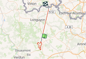

Length
55 km

Max alt
389 m

Uphill gradient
773 m
Km-Effort
65 km

Min alt
200 m

Downhill gradient
619 m
Boucle
No
Creation date :
2021-03-09 07:59:11.958
Updated on :
2021-03-09 16:34:02.038
8h33
Difficulty : Very easy

FREE GPS app for hiking
 SityTrail
IGN / Geographical institutes
SityTrail Plus
The world is yours!
About
Trail Walking of 55 km to be discovered at Grand Est, Meuse, Senon. This trail is proposed by AlainQuent.
Description
marche
Positioning
Country:
France
Region :
Grand Est
Department/Province :
Meuse
Municipality :
Senon
Location:
Unknown
Start:(Dec)
Start:(UTM)
692159 ; 5461831 (31U) N.
Comments