


G2 Pène Oubac - Le Teilhet

mitch1952
User
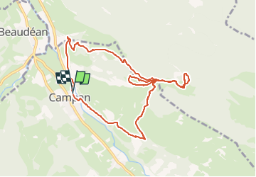

Length
10.4 km

Max alt
1369 m

Uphill gradient
788 m
Km-Effort
21 km

Min alt
651 m

Downhill gradient
792 m
Boucle
Yes
Creation date :
2021-03-10 15:33:41.354
Updated on :
2022-06-08 10:33:25.616
4h45
Difficulty : Very difficult

FREE GPS app for hiking
 SityTrail
IGN / Geographical institutes
SityTrail Plus
The world is yours!
About
Trail Walking of 10.4 km to be discovered at Occitania, Hautespyrenees, Campan. This trail is proposed by mitch1952.
Description
Randonnée effectuée le 10 mars 2021 avec Jacky , uniquement en matinée . Fin de la randonnée à 12h41
Positioning
Country:
France
Region :
Occitania
Department/Province :
Hautespyrenees
Municipality :
Campan
Location:
Unknown
Start:(Dec)
Start:(UTM)
270066 ; 4766683 (31T) N.
Comments