


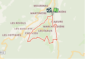
Boucle autour de saint Hugues

choubaka77
User

Length
7.2 km

Max alt
1091 m

Uphill gradient
264 m
Km-Effort
10.7 km

Min alt
882 m

Downhill gradient
265 m
Boucle
Yes
Creation date :
2021-03-10 13:11:28.0
Updated on :
2021-03-12 17:29:16.034
2h37
Difficulty : Easy

FREE GPS app for hiking
 SityTrail
IGN / Geographical institutes
SityTrail Plus
The world is yours!
About
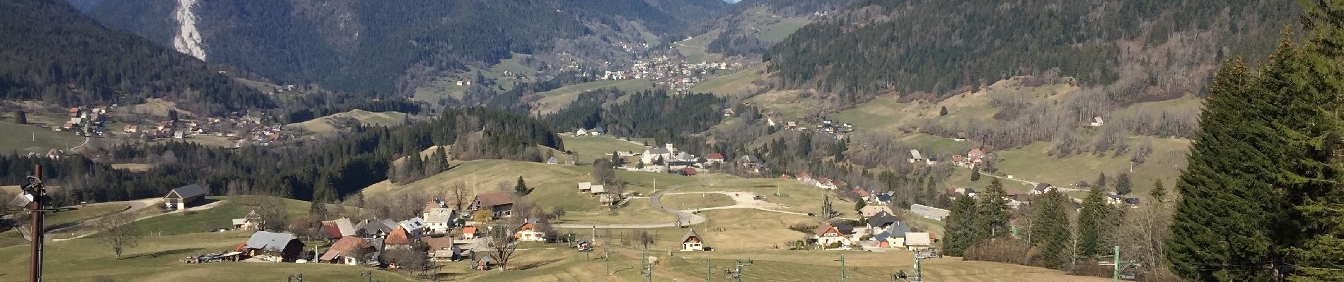
Trail Walking of 7.2 km to be discovered at Auvergne-Rhône-Alpes, Isère, Saint-Pierre-de-Chartreuse. This trail is proposed by choubaka77.
Photos


Positioning
Country:
France
Region :
Auvergne-Rhône-Alpes
Department/Province :
Isère
Municipality :
Saint-Pierre-de-Chartreuse
Location:
Unknown
Start:(Dec)
Start:(UTM)
719946 ; 5022788 (31T) N.
Comments