


Boucle Roquebrune /valdinguarde

lenezdanslesetoiles
User
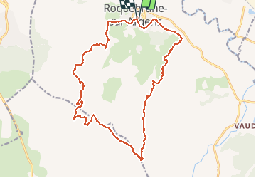

Length
21 km

Max alt
399 m

Uphill gradient
507 m
Km-Effort
28 km

Min alt
10 m

Downhill gradient
505 m
Boucle
Yes
Creation date :
2021-03-11 06:53:52.0
Updated on :
2021-03-11 10:20:22.169
3h26
Difficulty : Difficult

FREE GPS app for hiking
 SityTrail
IGN / Geographical institutes
SityTrail Plus
The world is yours!
About
Trail Walking of 21 km to be discovered at Provence-Alpes-Côte d'Azur, Var, Roquebrune-sur-Argens. This trail is proposed by lenezdanslesetoiles.
Description
Un Km très raide a mi parcours sinon rien à part la longueur
Positioning
Country:
France
Region :
Provence-Alpes-Côte d'Azur
Department/Province :
Var
Municipality :
Roquebrune-sur-Argens
Location:
Unknown
Start:(Dec)
Start:(UTM)
308850 ; 4812604 (32T) N.
Comments