


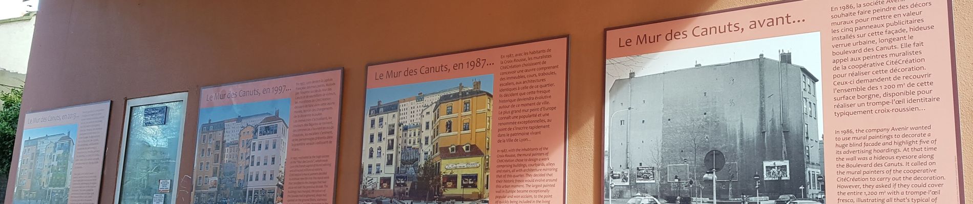
Croix Rousse-Caluire et Cuire-Tête d'Or-Croix Rousse

VANDERPUTTENMi
User GUIDE
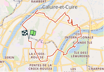

Length
11.4 km

Max alt
283 m

Uphill gradient
257 m
Km-Effort
14.8 km

Min alt
165 m

Downhill gradient
257 m
Boucle
Yes
Creation date :
2021-03-12 09:56:49.938
Updated on :
2021-03-12 16:35:48.636
3h01
Difficulty : Medium

FREE GPS app for hiking
 SityTrail
IGN / Geographical institutes
SityTrail Plus
The world is yours!
About
Trail Walking of 11.4 km to be discovered at Auvergne-Rhône-Alpes, Métropole de Lyon, Lyon. This trail is proposed by VANDERPUTTENMi.
Photos


Positioning
Country:
France
Region :
Auvergne-Rhône-Alpes
Department/Province :
Métropole de Lyon
Municipality :
Lyon
Location:
Lyon 4e Arrondissement
Start:(Dec)
Start:(UTM)
641780 ; 5071611 (31T) N.
Comments