


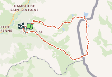
depart fouillouse ; tour du brec de chambeyron

gerardmicheline
User

Length
19 km

Max alt
2923 m

Uphill gradient
1392 m
Km-Effort
37 km

Min alt
1862 m

Downhill gradient
1367 m
Boucle
Yes
Creation date :
2021-03-15 08:24:20.542
Updated on :
2021-03-15 08:25:17.368
8h31
Difficulty : Very difficult

FREE GPS app for hiking
 SityTrail
IGN / Geographical institutes
SityTrail Plus
The world is yours!
About
Trail Walking of 19 km to be discovered at Provence-Alpes-Côte d'Azur, Alpes-de-Haute-Provence, Saint-Paul-sur-Ubaye. This trail is proposed by gerardmicheline.
Positioning
Country:
France
Region :
Provence-Alpes-Côte d'Azur
Department/Province :
Alpes-de-Haute-Provence
Municipality :
Saint-Paul-sur-Ubaye
Location:
Unknown
Start:(Dec)
Start:(UTM)
324922 ; 4932513 (32T) N.
Comments