


BELBRIETTE

surceneux
User
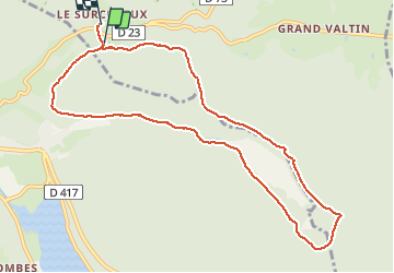

Length
9.9 km

Max alt
916 m

Uphill gradient
213 m
Km-Effort
12.8 km

Min alt
810 m

Downhill gradient
226 m
Boucle
No
Creation date :
2021-03-15 13:14:40.001
Updated on :
2021-03-15 23:59:15.162
2h31
Difficulty : Very easy

FREE GPS app for hiking
 SityTrail
IGN / Geographical institutes
SityTrail Plus
The world is yours!
About
Trail Touring skiing of 9.9 km to be discovered at Grand Est, Vosges, Ban-sur-Meurthe-Clefcy. This trail is proposed by surceneux.
Description
BELBRIETTE TOUR DEPUIS LE SURCENEUX AR (SKI RAQUETTE)
Positioning
Country:
France
Region :
Grand Est
Department/Province :
Vosges
Municipality :
Ban-sur-Meurthe-Clefcy
Location:
Unknown
Start:(Dec)
Start:(UTM)
347861 ; 5328835 (32U) N.
Comments