


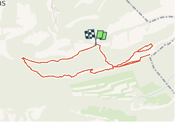
Tour des Dentelles de Montmirail

lionelnottat
User

Length
5.7 km

Max alt
584 m

Uphill gradient
301 m
Km-Effort
9.7 km

Min alt
399 m

Downhill gradient
296 m
Boucle
Yes
Creation date :
2021-03-18 08:10:31.963
Updated on :
2021-03-18 08:11:08.076
2h12
Difficulty : Medium

FREE GPS app for hiking
 SityTrail
IGN / Geographical institutes
SityTrail Plus
The world is yours!
About
Trail Walking of 5.7 km to be discovered at Provence-Alpes-Côte d'Azur, Vaucluse, Gigondas. This trail is proposed by lionelnottat.
Positioning
Country:
France
Region :
Provence-Alpes-Côte d'Azur
Department/Province :
Vaucluse
Municipality :
Gigondas
Location:
Unknown
Start:(Dec)
Start:(UTM)
661863 ; 4891479 (31T) N.
Comments