


Source de la Ripelle

soca
User

Length
8.6 km

Max alt
440 m

Uphill gradient
403 m
Km-Effort
14 km

Min alt
90 m

Downhill gradient
404 m
Boucle
Yes
Creation date :
2021-03-19 05:10:30.773
Updated on :
2022-01-21 23:22:50.1
3h30
Difficulty : Medium

FREE GPS app for hiking
 SityTrail
IGN / Geographical institutes
SityTrail Plus
The world is yours!
About
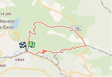
Trail Walking of 8.6 km to be discovered at Provence-Alpes-Côte d'Azur, Var, Le Revest-les-Eaux. This trail is proposed by soca.
Description
Dardenne, source de la Ripelle, GR51, château Tourris, vieille Valette, grotte de sable, barrage du Revest, Touravelle, retour.
Positioning
Country:
France
Region :
Provence-Alpes-Côte d'Azur
Department/Province :
Var
Municipality :
Le Revest-les-Eaux
Location:
Unknown
Start:(Dec)
Start:(UTM)
738843 ; 4783399 (31T) N.
Comments