


Le tour de Beaune le froid

zefreefly
User
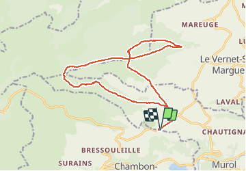

Length
19 km

Max alt
1378 m

Uphill gradient
532 m
Km-Effort
26 km

Min alt
1036 m

Downhill gradient
532 m
Boucle
Yes
Creation date :
2021-03-19 07:38:40.0
Updated on :
2021-03-19 15:34:04.115
7h37
Difficulty : Easy

FREE GPS app for hiking
 SityTrail
IGN / Geographical institutes
SityTrail Plus
The world is yours!
About
Trail Walking of 19 km to be discovered at Auvergne-Rhône-Alpes, Puy-de-Dôme, Murol. This trail is proposed by zefreefly.
Description
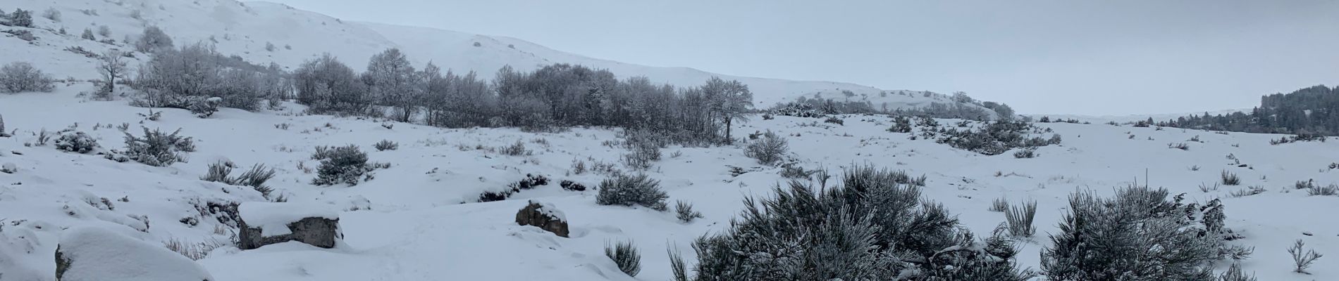
Belle balade Buron et paysage, fait en hiver raquette et marche avec 10 cm de neige magique.
Avec la neige deux passage sans balisage n’y chemin visible. Mais la trace est ok.
Photos


Positioning
Country:
France
Region :
Auvergne-Rhône-Alpes
Department/Province :
Puy-de-Dôme
Municipality :
Murol
Location:
Unknown
Start:(Dec)
Start:(UTM)
493023 ; 5048066 (31T) N.
Comments