


Cancale - Pointe du Grouin

meunier.ph.
User
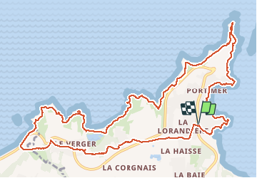

Length
14.7 km

Max alt
51 m

Uphill gradient
228 m
Km-Effort
17.7 km

Min alt
3 m

Downhill gradient
227 m
Boucle
Yes
Creation date :
2021-03-19 09:36:49.784
Updated on :
2021-03-19 16:49:05.909
3h30
Difficulty : Easy

FREE GPS app for hiking
 SityTrail
IGN / Geographical institutes
SityTrail Plus
The world is yours!
About
Trail Walking of 14.7 km to be discovered at Brittany, Ille-et-Vilaine, Cancale. This trail is proposed by meunier.ph..
Description
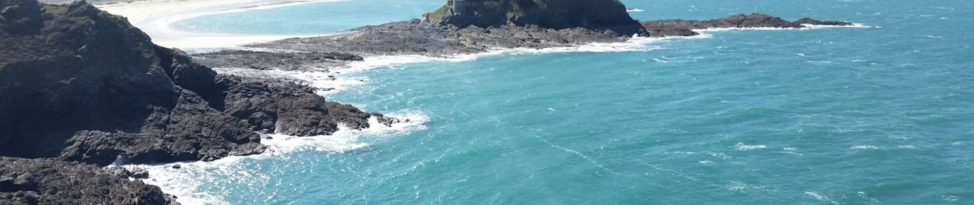
Boucle depuis le Port Picain. Sentier côtier par la pointe du Grouin jusqu'à l'île Du Guesclin puis retour par l'intérieure des terres.
Jolie côte découpée avec de belles plages et criques.
Photos


Positioning
Country:
France
Region :
Brittany
Department/Province :
Ille-et-Vilaine
Municipality :
Cancale
Location:
Unknown
Start:(Dec)
Start:(UTM)
584448 ; 5394329 (30U) N.
Comments