


mourre

JimBlues
User
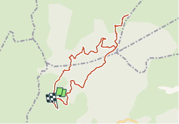

Length
10.7 km

Max alt
518 m

Uphill gradient
327 m
Km-Effort
15.1 km

Min alt
247 m

Downhill gradient
333 m
Boucle
Yes
Creation date :
2021-03-20 08:20:01.768
Updated on :
2021-03-20 10:39:53.499
2h15
Difficulty : Medium

FREE GPS app for hiking
 SityTrail
IGN / Geographical institutes
SityTrail Plus
The world is yours!
About
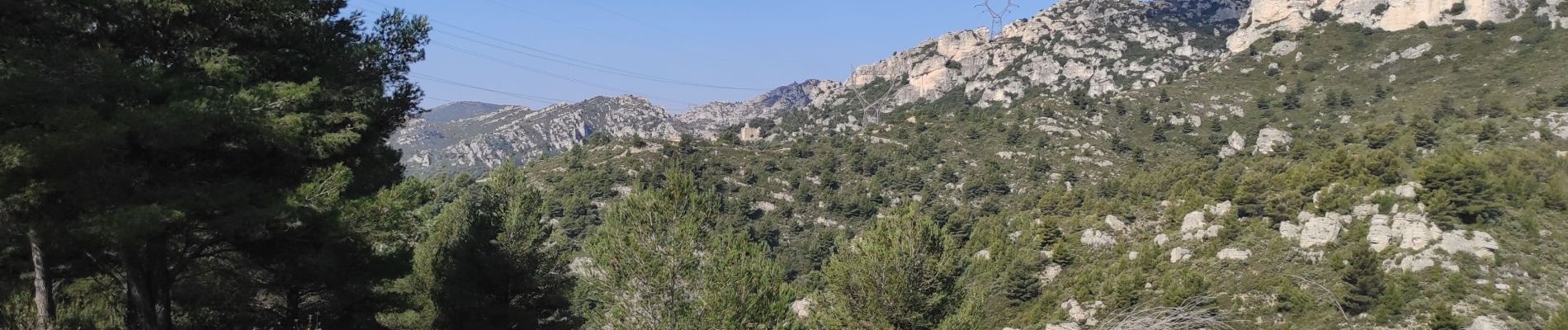
Trail Nordic walking of 10.7 km to be discovered at Provence-Alpes-Côte d'Azur, Bouches-du-Rhône, Allauch. This trail is proposed by JimBlues.
Photos


Positioning
Country:
France
Region :
Provence-Alpes-Côte d'Azur
Department/Province :
Bouches-du-Rhône
Municipality :
Allauch
Location:
Unknown
Start:(Dec)
Start:(UTM)
701144 ; 4805471 (31T) N.
Comments