


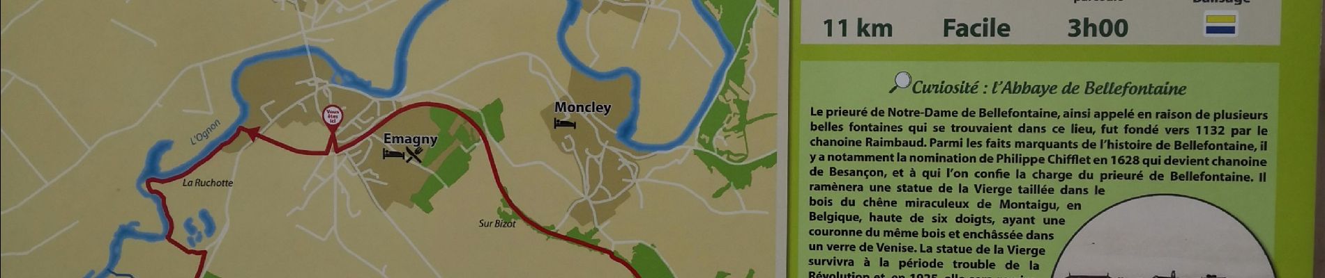
Le tour des Rompeux

i20
User

Length
8.9 km

Max alt
242 m

Uphill gradient
83 m
Km-Effort
10 km

Min alt
199 m

Downhill gradient
81 m
Boucle
Yes
Creation date :
2021-03-21 12:21:34.481
Updated on :
2021-03-21 14:11:10.232
1h48
Difficulty : Easy

FREE GPS app for hiking
 SityTrail
IGN / Geographical institutes
SityTrail Plus
The world is yours!
About
Trail Walking of 8.9 km to be discovered at Bourgogne-Franche-Comté, Doubs, Émagny. This trail is proposed by i20.
Photos

Positioning
Country:
France
Region :
Bourgogne-Franche-Comté
Department/Province :
Doubs
Municipality :
Émagny
Location:
Unknown
Start:(Dec)
Start:(UTM)
716792 ; 5243816 (31T) N.
Comments