


2021-03-21 Journée St Nabor Mt Ste Odile

holtzv
User GUIDE
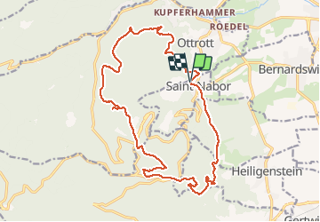

Length
19 km

Max alt
834 m

Uphill gradient
660 m
Km-Effort
28 km

Min alt
311 m

Downhill gradient
663 m
Boucle
Yes
Creation date :
2021-03-21 08:57:17.427
Updated on :
2021-03-21 14:26:25.043
4h11
Difficulty : Very easy

FREE GPS app for hiking
 SityTrail
IGN / Geographical institutes
SityTrail Plus
The world is yours!
About
Trail Horseback riding of 19 km to be discovered at Grand Est, Bas-Rhin, Saint-Nabor. This trail is proposed by holtzv.
Positioning
Country:
France
Region :
Grand Est
Department/Province :
Bas-Rhin
Municipality :
Saint-Nabor
Location:
Unknown
Start:(Dec)
Start:(UTM)
383269 ; 5367178 (32U) N.
Comments