


13 Marseille la Bruyere Mt St Cyr Carpiagne

Nathy8913
User
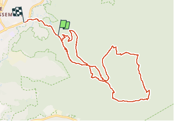

Length
13.2 km

Max alt
639 m

Uphill gradient
823 m
Km-Effort
24 km

Min alt
65 m

Downhill gradient
908 m
Boucle
No
Creation date :
2021-03-21 07:38:01.535
Updated on :
2021-03-21 15:34:19.466
6h53
Difficulty : Difficult

FREE GPS app for hiking
 SityTrail
IGN / Geographical institutes
SityTrail Plus
The world is yours!
About
Trail Walking of 13.2 km to be discovered at Provence-Alpes-Côte d'Azur, Bouches-du-Rhône, Marseille. This trail is proposed by Nathy8913.
Positioning
Country:
France
Region :
Provence-Alpes-Côte d'Azur
Department/Province :
Bouches-du-Rhône
Municipality :
Marseille
Location:
10th Arrondissement
Start:(Dec)
Start:(UTM)
698597 ; 4793768 (31T) N.
Comments