


mayronnes

elexine23
User
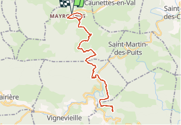

Length
23 km

Max alt
501 m

Uphill gradient
848 m
Km-Effort
35 km

Min alt
197 m

Downhill gradient
849 m
Boucle
Yes
Creation date :
2021-03-21 07:53:55.368
Updated on :
2021-03-21 16:24:26.363
7h59
Difficulty : Medium

FREE GPS app for hiking
 SityTrail
IGN / Geographical institutes
SityTrail Plus
The world is yours!
About
Trail Walking of 23 km to be discovered at Occitania, Aude, Mayronnes. This trail is proposed by elexine23.
Positioning
Country:
France
Region :
Occitania
Department/Province :
Aude
Municipality :
Mayronnes
Location:
Unknown
Start:(Dec)
Start:(UTM)
461627 ; 4767356 (31T) N.
Comments