


revin.bois bryas2.2021.03.21

trusgnachjf
User

Length
12.7 km

Max alt
391 m

Uphill gradient
420 m
Km-Effort
18.3 km

Min alt
120 m

Downhill gradient
425 m
Boucle
No
Creation date :
2021-03-21 12:43:07.327
Updated on :
2021-03-22 09:28:38.858
3h49
Difficulty : Very easy

FREE GPS app for hiking
 SityTrail
IGN / Geographical institutes
SityTrail Plus
The world is yours!
About
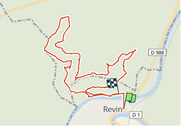
Trail Walking of 12.7 km to be discovered at Grand Est, Ardennes, Revin. This trail is proposed by trusgnachjf.
Positioning
Country:
France
Region :
Grand Est
Department/Province :
Ardennes
Municipality :
Revin
Location:
Unknown
Start:(Dec)
Start:(UTM)
617755 ; 5533485 (31U) N.
Comments