


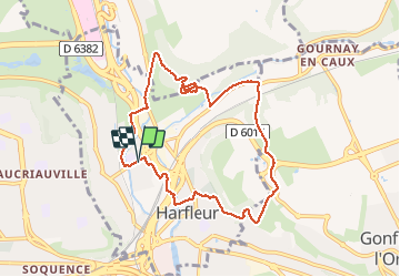
Harfleur - Fleurville

DDLEDANDY
User

Length
8 km

Max alt
91 m

Uphill gradient
175 m
Km-Effort
10.4 km

Min alt
1 m

Downhill gradient
175 m
Boucle
Yes
Creation date :
2021-03-23 07:50:04.946
Updated on :
2021-03-23 09:46:19.592
1h55
Difficulty : Easy

FREE GPS app for hiking
 SityTrail
IGN / Geographical institutes
SityTrail Plus
The world is yours!
About
Trail Walking of 8 km to be discovered at Normandy, Seine-Maritime, Harfleur. This trail is proposed by DDLEDANDY.
Description
Ballade facile qui se termine en apothéose par la dechetterie sauvage d'Harfleur
Positioning
Country:
France
Region :
Normandy
Department/Province :
Seine-Maritime
Municipality :
Harfleur
Location:
Unknown
Start:(Dec)
Start:(UTM)
296792 ; 5488232 (31U) N.
Comments