Potensac parcours 17

at12
User
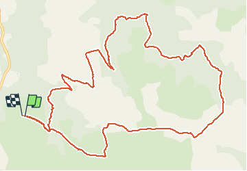

Length
15.8 km

Max alt
794 m

Uphill gradient
382 m
Km-Effort
21 km

Min alt
589 m

Downhill gradient
382 m
Boucle
Yes
Creation date :
2021-03-24 12:36:36.966
Updated on :
2021-03-24 15:25:06.435
2h47
Difficulty : Very easy

FREE GPS app for hiking
 SityTrail
IGN / Geographical institutes
SityTrail Plus
The world is yours!
About
Trail Walking of 15.8 km to be discovered at Occitania, Aveyron, Millau. This trail is proposed by at12.
Positioning
Country:
France
Region :
Occitania
Department/Province :
Aveyron
Municipality :
Millau
Location:
Unknown
Start:(Dec)
Start:(UTM)
510463 ; 4880343 (31T) N.
Comments