


test

cchatma
User
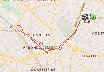

Length
5.4 km

Max alt
109 m

Uphill gradient
86 m
Km-Effort
6.5 km

Min alt
43 m

Downhill gradient
85 m
Boucle
Yes
Creation date :
2021-03-24 12:53:01.084
Updated on :
2021-03-24 16:21:50.287
1h46
Difficulty : Very easy

FREE GPS app for hiking
 SityTrail
IGN / Geographical institutes
SityTrail Plus
The world is yours!
About
Trail Walking of 5.4 km to be discovered at Ile-de-France, Paris, Paris. This trail is proposed by cchatma.
Positioning
Country:
France
Region :
Ile-de-France
Department/Province :
Paris
Municipality :
Paris
Location:
18th Arrondissement
Start:(Dec)
Start:(UTM)
451394 ; 5415286 (31U) N.
Comments