


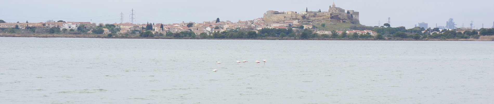
Fos - tour etang de l'Estomac

mhetpierre
User
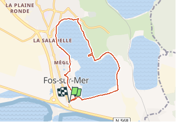

Length
8.3 km

Max alt
23 m

Uphill gradient
71 m
Km-Effort
9.2 km

Min alt
-5 m

Downhill gradient
71 m
Boucle
Yes
Creation date :
2021-03-24 18:55:20.444
Updated on :
2021-03-27 11:05:54.556
2h05
Difficulty : Easy

FREE GPS app for hiking
 SityTrail
IGN / Geographical institutes
SityTrail Plus
The world is yours!
About
Trail On foot of 8.3 km to be discovered at Provence-Alpes-Côte d'Azur, Bouches-du-Rhône, Fos-sur-Mer. This trail is proposed by mhetpierre.
Photos


Positioning
Country:
France
Region :
Provence-Alpes-Côte d'Azur
Department/Province :
Bouches-du-Rhône
Municipality :
Fos-sur-Mer
Location:
Unknown
Start:(Dec)
Start:(UTM)
657578 ; 4810672 (31T) N.
Comments