Trail Walking Boudes - Boudes_Cheminees_Fees - Photo
 jagarnier
jagarnier

User GUIDE

© OpenStreetMap contributors
Length
Length
5.9 km
Max alt
Max alt
565 m
Uphill gradient
Uphill gradient
172 m
Km-Effort
Km-Effort  
8.2 km
Min alt
Min alt
458 m
Downhill gradient
Downhill gradient
172 m
Boucle
Boucle
Yes
Creation date :
2021-03-27 07:00:59.554
Updated on :
2024-10-24 09:21:47.001

(1 Reviews)

Walking
Walking
1h45
Difficulty : Easy

Scan this QR Code to open this trail in the SityTrail application

FREE GPS app for hiking

Logo SityTrail SityTrail

IGN / Geographical institutes

Download SityTrail from the App Store Download SityTrail from Google Play

Logo SityTrail SityTrail Plus

The world is yours!

Download SityTrail from the App Store Download SityTrail from Google Play Download SityTrail on Huawei AppGallery

About

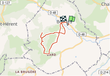
Trail Walking of 5.9 km to be discovered at Auvergne-Rhône-Alpes, Puy-de-Dôme, Boudes. This trail is proposed by jagarnier.

Description

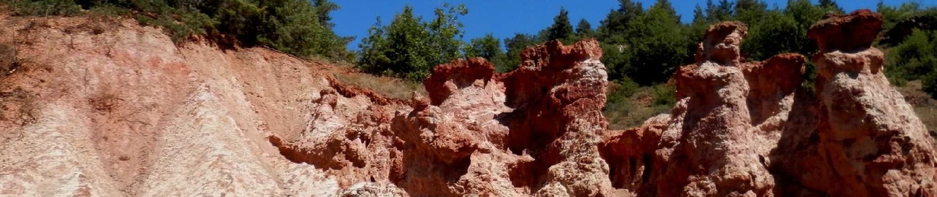
Ce site insolite, digne de paysages de western, est composé de magnifiques cheminées d’argile rouge.
Les vignes alentours produisent l’un des meilleurs vins d’Auvergne : Côtes-d'Auvergne-Boudes. Le village ensoleillé vaut le détour.

Elevation profile

Photos

Positioning

Country:
France
Region :
Auvergne-Rhône-Alpes
Department/Province :
Puy-de-Dôme
Municipality :
Boudes
Location:
Unknown
Start:(UTM)
514625 ; 5033748 (31T) N.

Comments

Please log in to post a review or rate the element


Close
My subscriptions