


2021-03-27_19h02m48_VTT Lasnes 22.04.2012
© OpenStreetMap contributors


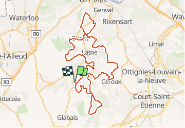
Length
42 km
Max alt
145 m
Uphill gradient
685 m
Km-Effort
51 km
Min alt
62 m
Downhill gradient
685 m
Boucle
Yes
Creation date :
2021-03-27 18:02:54.148
Updated on :
2021-03-27 18:02:54.463
FREE GPS app for hiking
 SityTrail
IGN / Geographical institutes
SityTrail Plus
The world is yours!
About
Trail of 42 km to be discovered at Wallonia, Walloon Brabant, Lasne. This trail is proposed by frederic.lorimier@skynet.be.
Positioning
Country:
Belgium
Region :
Wallonia
Department/Province :
Walloon Brabant
Municipality :
Lasne
Location:
Maransart
Start:(Dec)
Start:(UTM)
603559 ; 5613028 (31U) N.
Comments