


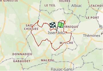
issendolus

bouscaillou
User

Length
17.8 km

Max alt
352 m

Uphill gradient
245 m
Km-Effort
21 km

Min alt
302 m

Downhill gradient
244 m
Boucle
Yes
Creation date :
2021-03-28 08:19:55.889
Updated on :
2021-03-28 14:34:36.773
6h10
Difficulty : Very difficult

FREE GPS app for hiking
 SityTrail
IGN / Geographical institutes
SityTrail Plus
The world is yours!
About
Trail Walking of 17.8 km to be discovered at Occitania, Lot, Issendolus. This trail is proposed by bouscaillou.
Positioning
Country:
France
Region :
Occitania
Department/Province :
Lot
Municipality :
Issendolus
Location:
Unknown
Start:(Dec)
Start:(UTM)
403963 ; 4955163 (31T) N.
Comments