


Lods - Le moine de la vallée

i20
User
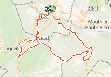

Length
11.9 km

Max alt
861 m

Uphill gradient
548 m
Km-Effort
19.3 km

Min alt
373 m

Downhill gradient
562 m
Boucle
Yes
Creation date :
2021-03-28 10:50:42.942
Updated on :
2021-03-28 14:43:54.272
3h52
Difficulty : Medium

FREE GPS app for hiking
 SityTrail
IGN / Geographical institutes
SityTrail Plus
The world is yours!
About
Trail Walking of 11.9 km to be discovered at Bourgogne-Franche-Comté, Doubs, Lods. This trail is proposed by i20.
Positioning
Country:
France
Region :
Bourgogne-Franche-Comté
Department/Province :
Doubs
Municipality :
Lods
Location:
Unknown
Start:(Dec)
Start:(UTM)
290878 ; 5213664 (32T) N.
Comments