


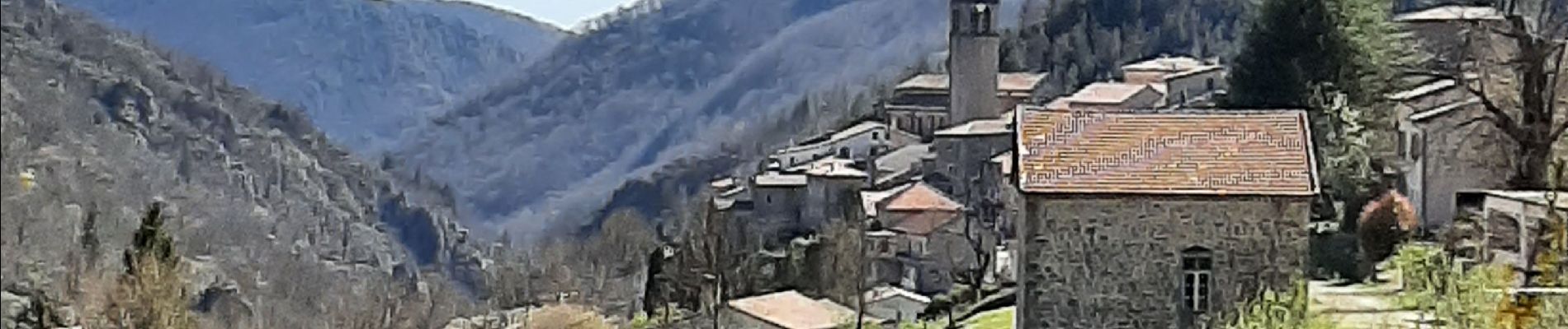
Le Mazoyer depuis Antraigues.

dcharbonnier
User
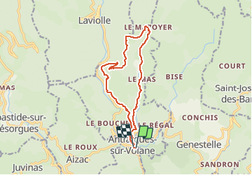

Length
14.1 km

Max alt
907 m

Uphill gradient
539 m
Km-Effort
21 km

Min alt
459 m

Downhill gradient
535 m
Boucle
Yes
Creation date :
2021-03-29 08:04:22.183
Updated on :
2021-03-29 13:37:00.331
4h37
Difficulty : Medium

FREE GPS app for hiking
 SityTrail
IGN / Geographical institutes
SityTrail Plus
The world is yours!
About
Trail Walking of 14.1 km to be discovered at Auvergne-Rhône-Alpes, Ardèche, Vallées-d'Antraigues-Asperjoc. This trail is proposed by dcharbonnier.
Description
Belle balade balcon de la Volane et retour par le val du Mas. Attention soyez bien chaussés.
Photos


Positioning
Country:
France
Region :
Auvergne-Rhône-Alpes
Department/Province :
Ardèche
Municipality :
Vallées-d'Antraigues-Asperjoc
Location:
Unknown
Start:(Dec)
Start:(UTM)
607644 ; 4952476 (31T) N.
Comments