


20210616- Etape 24- Condom- Eauze

ghislainem
User
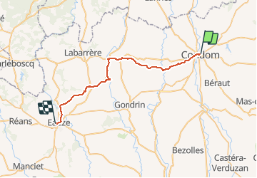

Length
35 km

Max alt
180 m

Uphill gradient
559 m
Km-Effort
42 km

Min alt
72 m

Downhill gradient
496 m
Boucle
No
Creation date :
2021-03-30 07:59:19.855
Updated on :
2021-05-03 14:51:35.381
9h23
Difficulty : Very difficult

FREE GPS app for hiking
 SityTrail
IGN / Geographical institutes
SityTrail Plus
The world is yours!
About
Trail On foot of 35 km to be discovered at Occitania, Gers, Condom. This trail is proposed by ghislainem.
Positioning
Country:
France
Region :
Occitania
Department/Province :
Gers
Municipality :
Condom
Location:
Unknown
Start:(Dec)
Start:(UTM)
289460 ; 4870430 (31T) N.
Comments