Trail Walking Chouvigny - La table de peraclos  - Photo
 Gegetop
Gegetop

User

© OpenStreetMap contributors
Length
Length
14.7 km
Max alt
Max alt
505 m
Uphill gradient
Uphill gradient
470 m
Km-Effort
Km-Effort  
21 km
Min alt
Min alt
326 m
Downhill gradient
Downhill gradient
468 m
Boucle
Boucle
Yes
Creation date :
2021-03-30 10:39:29.761
Updated on :
2021-03-30 15:38:39.054

(0 Reviews)

Walking
Walking
4h30
Difficulty : Difficult
Nordic walking
Nordic walking
4h05
Difficulty : Difficult

Scan this QR Code to open this trail in the SityTrail application

FREE GPS app for hiking

Logo SityTrail SityTrail

IGN / Geographical institutes

Download SityTrail from the App Store Download SityTrail from Google Play

Logo SityTrail SityTrail World

The world is yours!

Download SityTrail from the App Store Download SityTrail from Google Play Download SityTrail on Huawei AppGallery

About

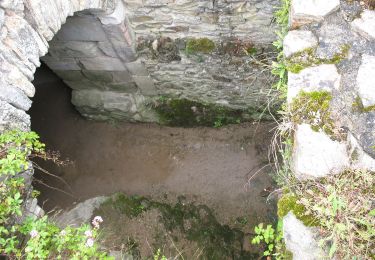
Trail Walking of 14.7 km to be discovered at Auvergne-Rhône-Alpes, Allier, Chouvigny. This trail is proposed by Gegetop.

Description

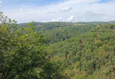
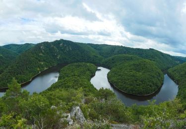
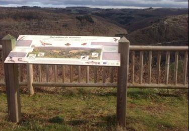
La boucle est très marquée par plusieurs dénivelés, plus de 900m de dénivelé cumulé.
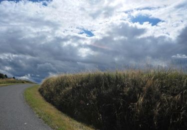
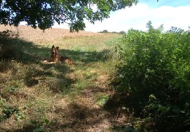
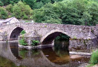
Le paysage est très agréable surtout au printemps.

Elevation profile

Photos

Positioning

Country:
France
Region :
Auvergne-Rhône-Alpes
Department/Province :
Allier
Municipality :
Chouvigny
Location:
Unknown
Start:(UTM)
499204 ; 5108195 (31T) N.

Trails nearby

Trail Walking Pouzol - Gorges de la Sioule - Pouzol   - Photo
Walking
tracegps

Walking

Difficult
(3)
Pouzol, Auvergne-Rhône-Alpes, Puy-de-Dôme, France
7.8 km | 12.2 km-effort
2h 30min
Yes
Trail On foot Saint-Rémy-de-Blot - Chateau-Rocher - Photo
On foot
PRO

On foot

Easy
Saint-Rémy-de-Blot, Auvergne-Rhône-Alpes, Puy-de-Dôme, France
4.7 km | 6.9 km-effort
1h 34min
Yes
Trail Walking Pouzol - Vallée de Chouvigny - Photo
Walking
jeriom

Walking

Medium
Pouzol, Auvergne-Rhône-Alpes, Puy-de-Dôme, France
51 km | 63 km-effort
3h 30min
No
Trail Walking Menat - Menat_Bords_Sioule - Photo
Walking
GUIDE
jagarnier

Walking

Medium
Menat, Auvergne-Rhône-Alpes, Puy-de-Dôme, France
14.9 km | 21 km-effort
4h 15min
Yes
Trail On foot Pouzol - Gorges de Chouvigny - Photo
On foot
PRO

On foot

Easy
Pouzol, Auvergne-Rhône-Alpes, Puy-de-Dôme, France
7.7 km | 12.1 km-effort
2h 45min
Yes
Trail Walking Nades - Le sentier des minerais - Photo
Walking
Gegetop

Walking

Easy
Nades, Auvergne-Rhône-Alpes, Allier, France
15.3 km | 20 km-effort
3h 4min
Yes
Trail Walking Menat - Menat_Pont - Photo
Walking
GUIDE
jagarnier

Walking

Medium
Menat, Auvergne-Rhône-Alpes, Puy-de-Dôme, France
9.7 km | 13.1 km-effort
2h 45min
Yes
Trail Walking Pouzol - pont de menat - Photo
Walking
didierb

Walking

Medium
Pouzol, Auvergne-Rhône-Alpes, Puy-de-Dôme, France
8.1 km | 10.8 km-effort
2h 1min
Yes
Trail On foot Servant - Servant la cascade de Champeaux et montignat - Photo
On foot
jeanic63

On foot

Medium
Servant, Auvergne-Rhône-Alpes, Puy-de-Dôme, France
21 km | 28 km-effort
6h 14min
Yes


Close
My subscriptions