


Thuin 03 04 21

andremusin
User
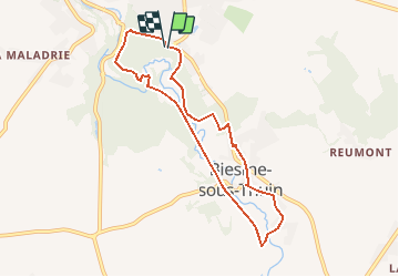

Length
7.1 km

Max alt
180 m

Uphill gradient
134 m
Km-Effort
8.8 km

Min alt
133 m

Downhill gradient
132 m
Boucle
Yes
Creation date :
2021-04-03 08:29:53.939
Updated on :
2021-04-03 08:31:00.921
2h00
Difficulty : Medium

FREE GPS app for hiking
 SityTrail
IGN / Geographical institutes
SityTrail Plus
The world is yours!
About
Trail Walking of 7.1 km to be discovered at Wallonia, Hainaut, Thuin. This trail is proposed by andremusin.
Positioning
Country:
Belgium
Region :
Wallonia
Department/Province :
Hainaut
Municipality :
Thuin
Location:
Thuin
Start:(Dec)
Start:(UTM)
592272 ; 5576560 (31U) N.
Comments