


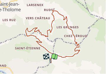
Chez Chardon - Reyret - Crêtes Rocher de l'Aigle - Chez béroud - Les Gallinons

Kargil
User GUIDE


4h34
Difficulty : Medium

FREE GPS app for hiking
 SityTrail
IGN / Geographical institutes
SityTrail Plus
The world is yours!
About
Trail Walking of 12.3 km to be discovered at Auvergne-Rhône-Alpes, Upper Savoy, Ayse. This trail is proposed by Kargil.
Description
Boucle au_dessus du massif de l'Aigle par Le Grand Château.
Crêtes non balisées. Suivre une faible trace qui finit par se perdre.
Descente par une belle combe mais peut-être possibilité de continuer sur la crête. A découvrir

Positioning
Comments