


revin.malgré tout4.2021.04.03

trusgnachjf
User
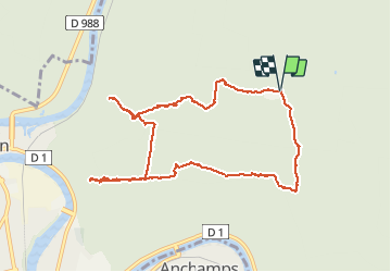

Length
9.5 km

Max alt
446 m

Uphill gradient
191 m
Km-Effort
12.1 km

Min alt
328 m

Downhill gradient
194 m
Boucle
Yes
Creation date :
2021-04-03 12:01:51.465
Updated on :
2021-04-03 14:35:35.234
2h31
Difficulty : Very easy

FREE GPS app for hiking
 SityTrail
IGN / Geographical institutes
SityTrail Plus
The world is yours!
About
Trail Walking of 9.5 km to be discovered at Grand Est, Ardennes, Revin. This trail is proposed by trusgnachjf.
Positioning
Country:
France
Region :
Grand Est
Department/Province :
Ardennes
Municipality :
Revin
Location:
Unknown
Start:(Dec)
Start:(UTM)
620795 ; 5534168 (31U) N.
Comments