


olne - Vaux sous chevremont

Georgette61
User
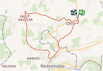

Length
8.2 km

Max alt
245 m

Uphill gradient
206 m
Km-Effort
10.9 km

Min alt
116 m

Downhill gradient
206 m
Boucle
Yes
Creation date :
2021-04-04 08:09:52.04
Updated on :
2021-04-04 10:31:20.308
2h20
Difficulty : Medium

FREE GPS app for hiking
 SityTrail
IGN / Geographical institutes
SityTrail Plus
The world is yours!
About
Trail Walking of 8.2 km to be discovered at Wallonia, Liège, Olne. This trail is proposed by Georgette61.
Positioning
Country:
Belgium
Region :
Wallonia
Department/Province :
Liège
Municipality :
Olne
Location:
Olne
Start:(Dec)
Start:(UTM)
694802 ; 5608042 (31U) N.
Comments