


D'une rive à l'autre par Azy

VANDERPUTTENMi
User GUIDE
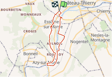

Length
12.1 km

Max alt
157 m

Uphill gradient
148 m
Km-Effort
14.1 km

Min alt
53 m

Downhill gradient
146 m
Boucle
Yes
Creation date :
2021-04-04 12:32:57.29
Updated on :
2021-04-04 17:40:39.444
2h45
Difficulty : Difficult

FREE GPS app for hiking
 SityTrail
IGN / Geographical institutes
SityTrail Plus
The world is yours!
About
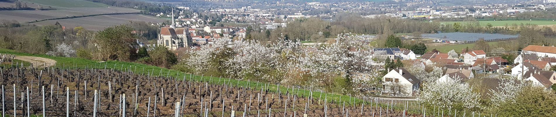
Trail Walking of 12.1 km to be discovered at Hauts-de-France, Aisne, Château-Thierry. This trail is proposed by VANDERPUTTENMi.
Photos


Positioning
Country:
France
Region :
Hauts-de-France
Department/Province :
Aisne
Municipality :
Château-Thierry
Location:
Unknown
Start:(Dec)
Start:(UTM)
527902 ; 5431915 (31U) N.
Comments