


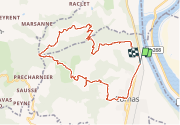
De Cornas à la Borne

Gilbertbancilhon
User

Length
12.3 km

Max alt
411 m

Uphill gradient
451 m
Km-Effort
18.3 km

Min alt
117 m

Downhill gradient
452 m
Boucle
Yes
Creation date :
2021-04-08 07:45:37.418
Updated on :
2021-04-08 12:42:44.907
4h51
Difficulty : Difficult

FREE GPS app for hiking
 SityTrail
IGN / Geographical institutes
SityTrail Plus
The world is yours!
About
Trail Walking of 12.3 km to be discovered at Auvergne-Rhône-Alpes, Ardèche, Cornas. This trail is proposed by Gilbertbancilhon.
Positioning
Country:
France
Region :
Auvergne-Rhône-Alpes
Department/Province :
Ardèche
Municipality :
Cornas
Location:
Unknown
Start:(Dec)
Start:(UTM)
646043 ; 4981507 (31T) N.
Comments
Jolie balade ardéchoise Gilbert à 2pas de Valence Michèle et Alain