


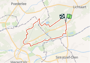
Lichtaart - Herentals

Bart.Bervoets
User

Length
13.6 km

Max alt
44 m

Uphill gradient
136 m
Km-Effort
15.4 km

Min alt
9 m

Downhill gradient
135 m
Boucle
Yes
Creation date :
2021-04-08 15:35:30.435
Updated on :
2021-04-08 16:49:34.053
3h20
Difficulty : Medium

FREE GPS app for hiking
 SityTrail
IGN / Geographical institutes
SityTrail Plus
The world is yours!
About
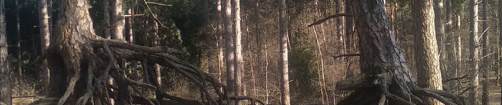
Trail Walking of 13.6 km to be discovered at Flanders, Antwerp, Kasterlee. This trail is proposed by Bart.Bervoets.
Description
Langs Bobbejaanland parallel met Kleine Nete richting Herentals. Terug via Toeristentoren, het Zwarte Water en Kempense Heuvelrug.
Parking : Camping Floreal
Photos


Positioning
Country:
Belgium
Region :
Flanders
Department/Province :
Antwerp
Municipality :
Kasterlee
Location:
Lichtaart
Start:(Dec)
Start:(UTM)
632764 ; 5675001 (31U) N.
Comments