


St Romain

ajd26
User

Length
18.5 km

Max alt
638 m

Uphill gradient
681 m
Km-Effort
28 km

Min alt
137 m

Downhill gradient
681 m
Boucle
Yes
Creation date :
2021-04-08 07:23:44.0
Updated on :
2021-04-09 07:21:28.845
5h30
Difficulty : Medium

FREE GPS app for hiking
 SityTrail
IGN / Geographical institutes
SityTrail Plus
The world is yours!
About
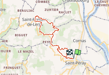
Trail Walking of 18.5 km to be discovered at Auvergne-Rhône-Alpes, Ardèche, Saint-Péray. This trail is proposed by ajd26.
Description
depart de St Peray et montée à St Romain par route et sentiers
beaux panoramas
Positioning
Country:
France
Region :
Auvergne-Rhône-Alpes
Department/Province :
Ardèche
Municipality :
Saint-Péray
Location:
Unknown
Start:(Dec)
Start:(UTM)
645219 ; 4978912 (31T) N.
Comments