Trail Mountain bike Virton - Gorcy  -  Balade_VTT_38kms - Photo

Gorcy - Balade_VTT_38kms

 Pascal L
Pascal L

User

© OpenStreetMap contributors
Length
Length
38 km
Max alt
Max alt
404 m
Uphill gradient
Uphill gradient
596 m
Km-Effort
Km-Effort  
46 km
Min alt
Min alt
201 m
Downhill gradient
Downhill gradient
596 m
Boucle
Boucle
Yes
Creation date :
2021-04-09 08:12:25.941
Updated on :
2022-12-11 20:53:27.747

(0 Reviews)

Mountain bike
Mountain bike
3h30
Difficulty : Difficult

Scan this QR Code to open this trail in the SityTrail application

FREE GPS app for hiking

Logo SityTrail SityTrail

IGN / Geographical institutes

Download SityTrail from the App Store Download SityTrail from Google Play

Logo SityTrail SityTrail World

The world is yours!

Download SityTrail from the App Store Download SityTrail from Google Play Download SityTrail on Huawei AppGallery

About

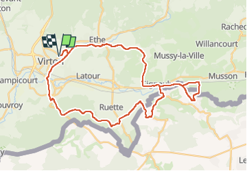
Trail Mountain bike of 38 km to be discovered at Wallonia, Luxembourg, Virton. This trail is proposed by Pascal L.

Description

Départ/Retour: Virton (Delhaize)
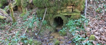
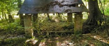
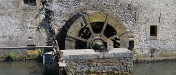
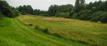
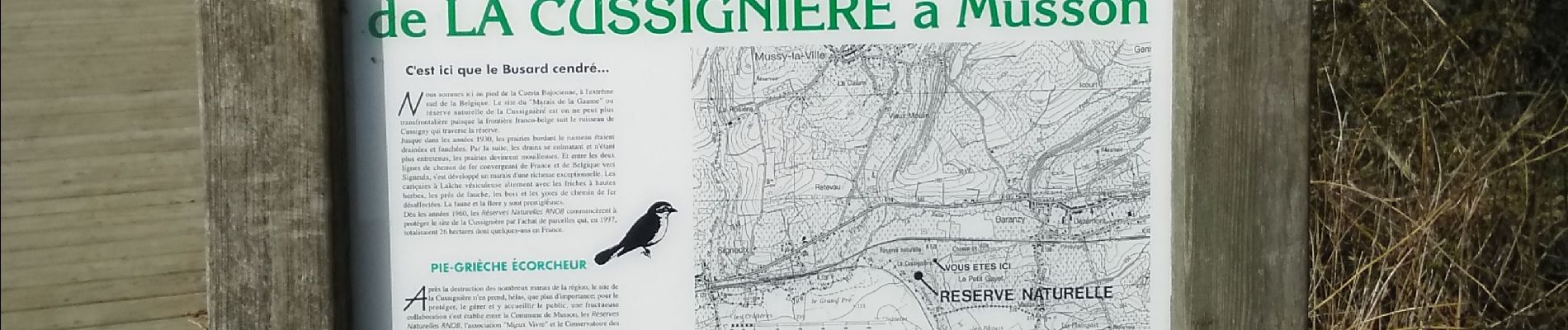
Endroits de passage: Pierrard, Ravel 155, Ethe, Bleid (Méronvau), Signeulx, voie lente, Cussigny, Gorcy (FR), le petit Gayet, marais de la Cuissignière, Ville-Houdlémont, Buré-la-Ville, Saint-Rémy, Grandcourt, Bois de la Sente, Croix Valentin, Pavillon de Chasse, Bois de la Côte, la Tuilerie, la Viérine, point de vues sur Saint-Mard, Vieux-Virton.

Vidéo: https://vimeo.com/736508030 (panorama sur le village de Grandcourt)

Ref.
- https://www.gorcy.fr
- https://fr.wikipedia.org/wiki/Gorcy
- https://www.natagora.be/balades/43594/download

(2021.04.09)

Elevation profile

Photos

Points of interest

Point of interest Virton - Unnamed POI - Photo
Pascal L
VIRTON 
Point of interest Saint-Pancré - Parcs éoliens des Deux Rivières (France) - Photo
Pascal L
Point of interest Virton - Sources du Bruzel - Photo
Pascal L
Point of interest Virton - Stockfontaine - Photo
Pascal L
Point of interest Virton - Moulin Naisse à Virton - Photo
Pascal L
Point of interest Virton - Croix de Hauteclocque - Photo
Pascal L

Positioning

Country:
Belgium
Region :
Wallonia
Department/Province :
Luxembourg
Municipality :
Virton
Location:
Virton
Start:(UTM)
683772 ; 5494017 (31U) N.

Trails nearby

Trail Walking Virton - RB-Lu-17_Ethe_via-var-1-et-2-et-3 - Photo
Walking
PRO

Walking

Very easy
(3)
Virton, Wallonia, Luxembourg, Belgium
29 km | 35 km-effort
7h 33min
Yes
Trail Mountain bike Virton - T2019-06-16-16-47 - Photo
Mountain bike
Pascal L

Mountain bike

Easy
(1)
Virton, Wallonia, Luxembourg, Belgium
21 km | 26 km-effort
1h 40min
Yes
Trail Walking Virton - GAUME Balade  naturelle et historique - Photo
Walking
julucasi

Walking

Very easy
(1)
Virton, Wallonia, Luxembourg, Belgium
5.2 km | 6.8 km-effort
1h 16min
Yes
Trail On foot Virton - La Bajocienne - Photo
On foot
GUIDE+

On foot

Easy
(1)
Virton, Wallonia, Luxembourg, Belgium
11 km | 14.5 km-effort
3h 17min
Yes
Trail On foot Virton - 12479951-Entre village et fruits - Photo
On foot
GUIDE
DUPONT Rita

On foot

Easy
Virton, Wallonia, Luxembourg, Belgium
6.4 km | 7.7 km-effort
1h 45min
Yes
Trail Walking Virton - RB-Lu-17_Ethe_via-racc - Photo
Walking
PRO

Walking

Very easy
Virton, Wallonia, Luxembourg, Belgium
15.6 km | 19.3 km-effort
4h 8min
Yes
Trail Walking Virton - RB-Lu-17_Ethe - Photo
Walking
PRO

Walking

Very easy
Virton, Wallonia, Luxembourg, Belgium
22 km | 28 km-effort
5h 55min
Yes
Trail Equestrian Rouvroy - rallye 2014 - Photo
Equestrian
christianegabriel

Equestrian

Medium
(1)
Rouvroy, Wallonia, Luxembourg, Belgium
26 km | 32 km-effort
4h 1min
Yes
Trail Mountain bike Virton - Autour de Tintigny  -  Balade_VTT_54Kms - Photo
Mountain bike
Pascal L

Mountain bike

Very difficult
Virton, Wallonia, Luxembourg, Belgium
54 km | 64 km-effort
4h 25min
Yes


Close
My subscriptions