


SityTrail - 4 Chemins des Routes - Le Croupatier - Le Broussan - Col du Corps de Garde

affinetataille
User GUIDE
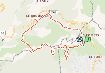

Length
11.7 km

Max alt
492 m

Uphill gradient
569 m
Km-Effort
19.3 km

Min alt
279 m

Downhill gradient
569 m
Boucle
Yes
Creation date :
2021-04-09 16:31:15.976
Updated on :
2021-05-18 22:06:36.187
6h00
Difficulty : Difficult

FREE GPS app for hiking
 SityTrail
IGN / Geographical institutes
SityTrail Plus
The world is yours!
About
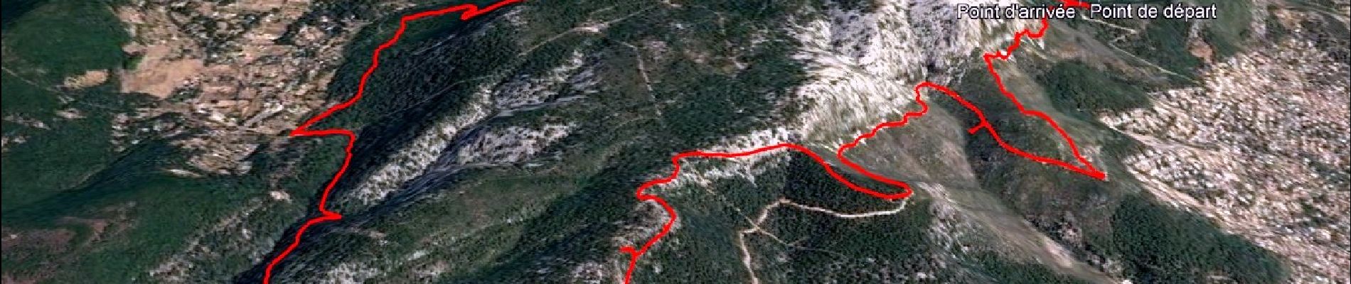
Trail Walking of 11.7 km to be discovered at Provence-Alpes-Côte d'Azur, Var, Toulon. This trail is proposed by affinetataille.
Description
Randonnée difficile par la nature du terrain très caillouteux.
Photos


26 photos in total. Please click on a photo to see them all in the gallery.
Positioning
Country:
France
Region :
Provence-Alpes-Côte d'Azur
Department/Province :
Var
Municipality :
Toulon
Location:
Unknown
Start:(Dec)
Start:(UTM)
735554 ; 4782669 (31T) N.
Comments