


2021-04-10_15h53m44_apie de sambalettes a partir de st christine

affinetataille
User GUIDE


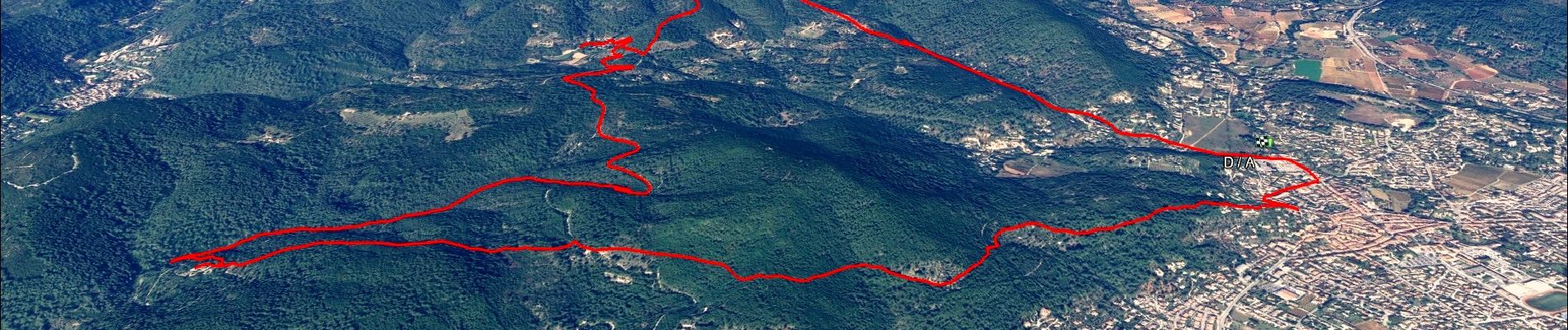
Length
17.5 km

Max alt
403 m

Uphill gradient
616 m
Km-Effort
26 km

Min alt
150 m

Downhill gradient
613 m
Boucle
Yes
Creation date :
2021-04-10 13:53:44.977
Updated on :
2022-05-13 09:21:22.824
6h00
Difficulty : Medium

FREE GPS app for hiking
 SityTrail
IGN / Geographical institutes
SityTrail Plus
The world is yours!
About
Trail Walking of 17.5 km to be discovered at Provence-Alpes-Côte d'Azur, Var, Cuers. This trail is proposed by affinetataille.
Photos


33 photos in total. Please click on a photo to see them all in the gallery.
Positioning
Country:
France
Region :
Provence-Alpes-Côte d'Azur
Department/Province :
Var
Municipality :
Cuers
Location:
Unknown
Start:(Dec)
Start:(UTM)
261787 ; 4791704 (32T) N.
Comments