


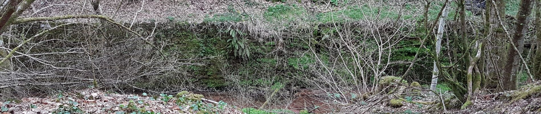
Champagney - canal de la Haute-Saône - tunnel

Bart2015
User
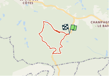

Length
5.5 km

Max alt
502 m

Uphill gradient
153 m
Km-Effort
7.5 km

Min alt
373 m

Downhill gradient
155 m
Boucle
Yes
Creation date :
2021-04-11 11:28:33.301
Updated on :
2021-04-11 16:15:55.69
1h10
Difficulty : Medium

FREE GPS app for hiking
 SityTrail
IGN / Geographical institutes
SityTrail Plus
The world is yours!
About
Trail Walking of 5.5 km to be discovered at Bourgogne-Franche-Comté, Haute-Saône, Champagney. This trail is proposed by Bart2015.
Description
Petite balade sympa pour longer le canal de la Haute Saône et découvrir la partie en sous-sol (accès tunnel interdit) ...
Bonne balade.
Photos


Positioning
Country:
France
Region :
Bourgogne-Franche-Comté
Department/Province :
Haute-Saône
Municipality :
Champagney
Location:
Unknown
Start:(Dec)
Start:(UTM)
326495 ; 5283079 (32T) N.
Comments