


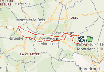
Vallée de la Montcient

Fky78
User

Length
15.2 km

Max alt
131 m

Uphill gradient
237 m
Km-Effort
18.4 km

Min alt
35 m

Downhill gradient
237 m
Boucle
Yes
Creation date :
2021-04-11 22:43:36.918
Updated on :
2021-04-11 22:47:08.696
4h10
Difficulty : Difficult

FREE GPS app for hiking
 SityTrail
IGN / Geographical institutes
SityTrail Plus
The world is yours!
About
Trail Walking of 15.2 km to be discovered at Ile-de-France, Yvelines, Gaillon-sur-Montcient. This trail is proposed by Fky78.
Description
Parcours longeant la Montcient et passant par la cave aux fées
Positioning
Country:
France
Region :
Ile-de-France
Department/Province :
Yvelines
Municipality :
Gaillon-sur-Montcient
Location:
Unknown
Start:(Dec)
Start:(UTM)
418980 ; 5430867 (31U) N.
Comments