


20210413 Forêt du Rouvray

Childebert
User
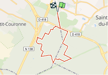

Length
7.8 km

Max alt
91 m

Uphill gradient
47 m
Km-Effort
8.4 km

Min alt
69 m

Downhill gradient
47 m
Boucle
Yes
Creation date :
2021-04-13 11:37:22.701
Updated on :
2021-04-13 14:00:31.199
2h07
Difficulty : Easy

FREE GPS app for hiking
 SityTrail
IGN / Geographical institutes
SityTrail Plus
The world is yours!
About
Trail Walking of 7.8 km to be discovered at Normandy, Seine-Maritime, Saint-Étienne-du-Rouvray. This trail is proposed by Childebert.
Positioning
Country:
France
Region :
Normandy
Department/Province :
Seine-Maritime
Municipality :
Saint-Étienne-du-Rouvray
Location:
Unknown
Start:(Dec)
Start:(UTM)
359249 ; 5472222 (31U) N.
Comments