


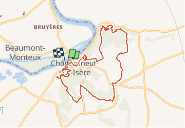
Châteauneuf/isere

cousam
User

Length
10.6 km

Max alt
247 m

Uphill gradient
315 m
Km-Effort
14.8 km

Min alt
126 m

Downhill gradient
313 m
Boucle
Yes
Creation date :
2021-04-13 11:32:31.307
Updated on :
2021-04-13 16:47:21.475
3h39
Difficulty : Easy

FREE GPS app for hiking
 SityTrail
IGN / Geographical institutes
SityTrail Plus
The world is yours!
About
Trail Walking of 10.6 km to be discovered at Auvergne-Rhône-Alpes, Drôme, Châteauneuf-sur-Isère. This trail is proposed by cousam.
Description
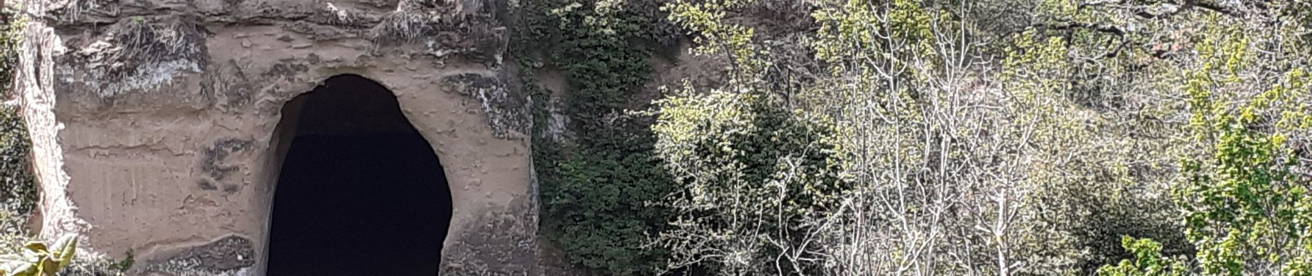
Boucle chemin des carriers
Photos


Positioning
Country:
France
Region :
Auvergne-Rhône-Alpes
Department/Province :
Drôme
Municipality :
Châteauneuf-sur-Isère
Location:
Unknown
Start:(Dec)
Start:(UTM)
652589 ; 4986477 (31T) N.
Comments