


Cascade de la Pise Chateauroux

Sorriaux
User
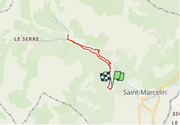

Length
11 km

Max alt
1517 m

Uphill gradient
353 m
Km-Effort
15.7 km

Min alt
1277 m

Downhill gradient
357 m
Boucle
Yes
Creation date :
2021-04-14 09:26:42.814
Updated on :
2021-04-14 15:34:47.606
3h31
Difficulty : Easy

FREE GPS app for hiking
 SityTrail
IGN / Geographical institutes
SityTrail Plus
The world is yours!
About
Trail Walking of 11 km to be discovered at Provence-Alpes-Côte d'Azur, Hautes-Alpes, Châteauroux-les-Alpes. This trail is proposed by Sorriaux.
Description
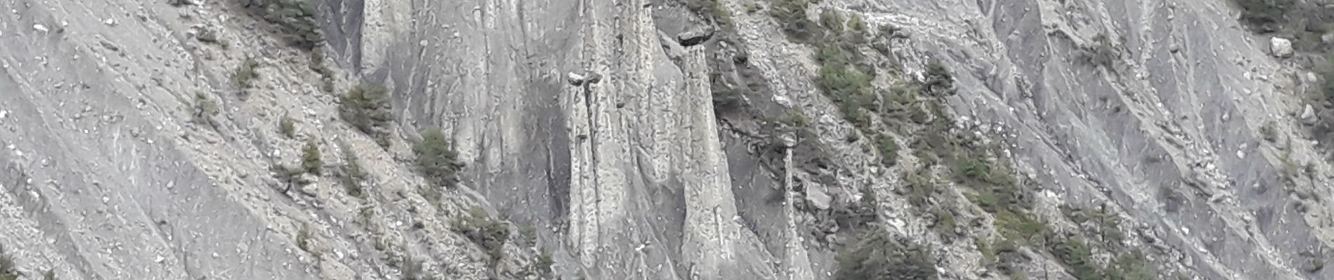
Cascade et demoiselles coiffées
Photos


Positioning
Country:
France
Region :
Provence-Alpes-Côte d'Azur
Department/Province :
Hautes-Alpes
Municipality :
Châteauroux-les-Alpes
Location:
Unknown
Start:(Dec)
Start:(UTM)
301735 ; 4944015 (32T) N.
Comments