Trail Walking Le Grand-Bornand - Col des Annes-Refuge de la Pointe Percée 14 07 2020 - Photo

Col des Annes-Refuge de la Pointe Percée 14 07 2020

© OpenStreetMap contributors
Length
Length
7.6 km
Max alt
Max alt
2161 m
Uphill gradient
Uphill gradient
464 m
Km-Effort
Km-Effort  
13.8 km
Min alt
Min alt
1721 m
Downhill gradient
Downhill gradient
467 m
Boucle
Boucle
Yes
Creation date :
2021-04-17 20:12:13.925
Updated on :
2021-04-21 11:43:29.005

(0 Reviews)

Walking
Walking
3h40
Difficulty : Medium

Scan this QR Code to open this trail in the SityTrail application

FREE GPS app for hiking

Logo SityTrail SityTrail

IGN / Geographical institutes

Download SityTrail from the App Store Download SityTrail from Google Play

Logo SityTrail SityTrail Plus

The world is yours!

Download SityTrail from the App Store Download SityTrail from Google Play Download SityTrail on Huawei AppGallery

About

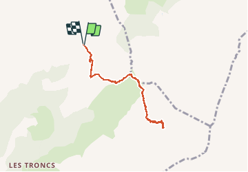
Trail Walking of 7.6 km to be discovered at Auvergne-Rhône-Alpes, Upper Savoy, Le Grand-Bornand. This trail is proposed by Hugues Michel.

Description

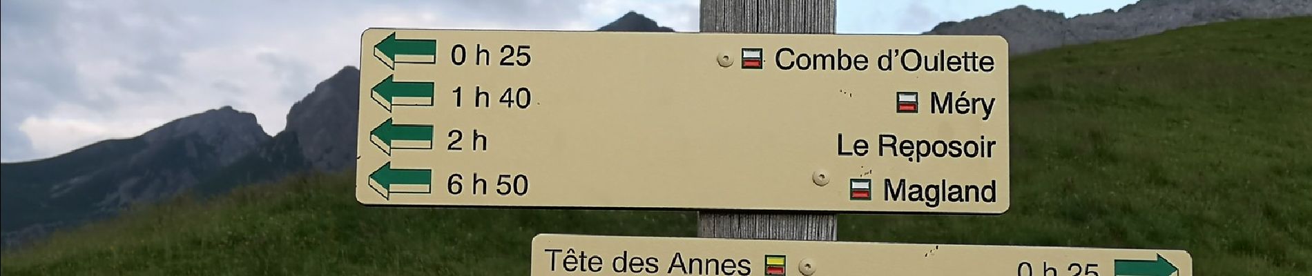
Du col des Annes jusqu'au refuge de Gramusset (ou refuge de la pointe percée). Possibilité de poursuivre en direction du point culminant de la chaîne des Aravis, une fois la crète atteinte, vue époustouflante sur la vallée de Sallanches et la chaîne du Mont Blanc. Parcours plus difficile cependant.

Elevation profile

Photos

Points of interest

Point of interest Le Grand-Bornand - 0CGZegR8--.1.jpg - Photo
Hugues Michel
LE GRAND-BORNAND 

Positioning

Country:
France
Region :
Auvergne-Rhône-Alpes
Department/Province :
Upper Savoy
Municipality :
Le Grand-Bornand
Location:
Unknown
Start:(UTM)
308213 ; 5093674 (32T) N.


Close
My subscriptions