


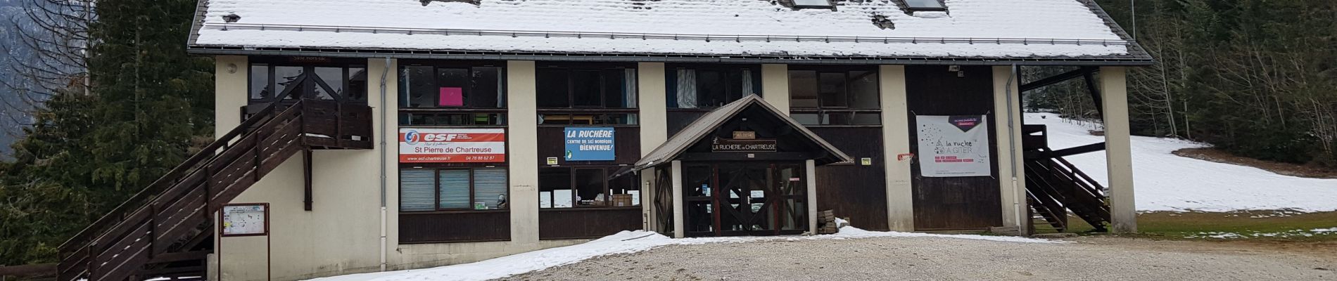
La Richère

Henri.Vekemans
User
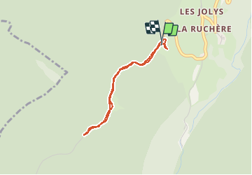

Length
2.9 km

Max alt
1235 m

Uphill gradient
73 m
Km-Effort
3.9 km

Min alt
1162 m

Downhill gradient
81 m
Boucle
Yes
Creation date :
2021-04-18 12:10:27.105
Updated on :
2021-04-18 13:05:10.305
54m
Difficulty : Easy

FREE GPS app for hiking
 SityTrail
IGN / Geographical institutes
SityTrail Plus
The world is yours!
About
Trail Walking of 2.9 km to be discovered at Auvergne-Rhône-Alpes, Isère, Saint-Christophe-sur-Guiers. This trail is proposed by Henri.Vekemans.
Photos


Positioning
Country:
France
Region :
Auvergne-Rhône-Alpes
Department/Province :
Isère
Municipality :
Saint-Christophe-sur-Guiers
Location:
Unknown
Start:(Dec)
Start:(UTM)
718856 ; 5032142 (31T) N.
Comments