


Depuis la Louve en boucle

ETMU5496
User
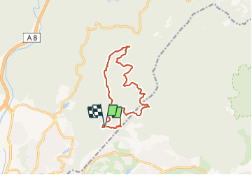

Length
13.2 km

Max alt
444 m

Uphill gradient
465 m
Km-Effort
19.4 km

Min alt
72 m

Downhill gradient
465 m
Boucle
Yes
Creation date :
2021-04-19 07:38:40.0
Updated on :
2021-07-10 15:31:02.367
3h07
Difficulty : Medium

FREE GPS app for hiking
 SityTrail
IGN / Geographical institutes
SityTrail Plus
The world is yours!
About
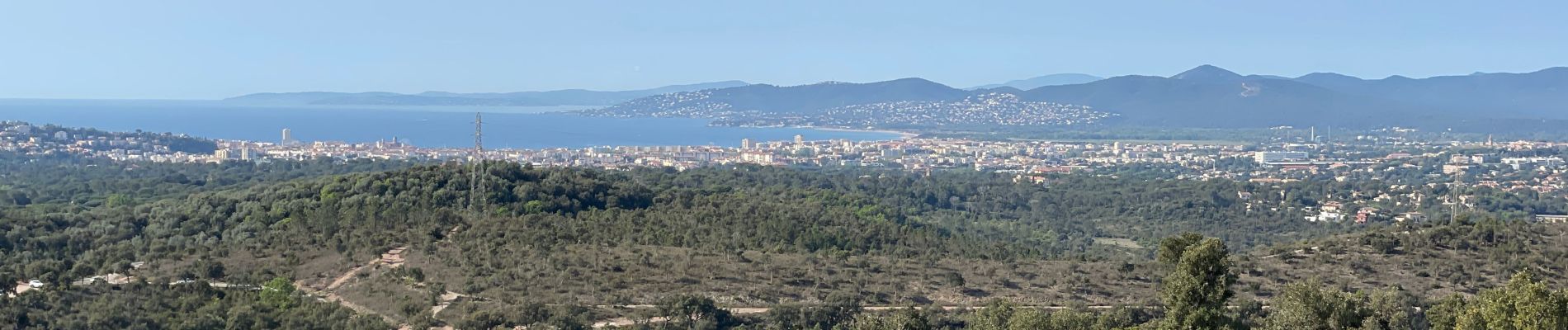
Trail Walking of 13.2 km to be discovered at Provence-Alpes-Côte d'Azur, Var, Fréjus. This trail is proposed by ETMU5496.
Description
incluant le col des sacs, le pas d'Adam, l'Aigre et retour par les petits lacs
Photos


21 photos in total. Please click on a photo to see them all in the gallery.
Positioning
Country:
France
Region :
Provence-Alpes-Côte d'Azur
Department/Province :
Var
Municipality :
Fréjus
Location:
Unknown
Start:(Dec)
Start:(UTM)
321228 ; 4814916 (32T) N.
Comments