


Mer des Sables - Beloeil

mozzipsc
User
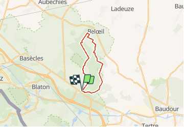

Length
15.3 km

Max alt
99 m

Uphill gradient
148 m
Km-Effort
17.2 km

Min alt
52 m

Downhill gradient
150 m
Boucle
Yes
Creation date :
2021-04-21 07:23:47.747
Updated on :
2021-04-22 13:45:32.607
5h14
Difficulty : Easy

FREE GPS app for hiking
 SityTrail
IGN / Geographical institutes
SityTrail Plus
The world is yours!
About
Trail Walking of 15.3 km to be discovered at Wallonia, Hainaut, Belœil. This trail is proposed by mozzipsc.
Description
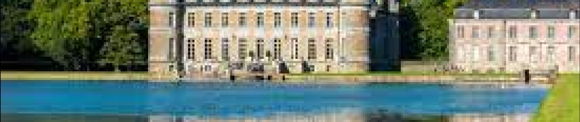
Départ de la Mer des Sables Stambruges et traversée des bois jusqu'au château de Beloeil.
Photos

Positioning
Country:
Belgium
Region :
Wallonia
Department/Province :
Hainaut
Municipality :
Belœil
Location:
Stambruges
Start:(Dec)
Start:(UTM)
550879 ; 5594121 (31U) N.
Comments