


68.702 Oelegem - Vrieselhof

ADL339
User
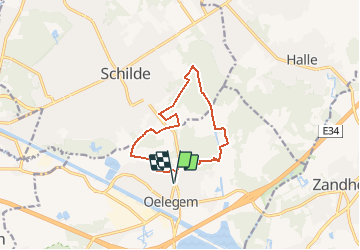

Length
10.1 km

Max alt
21 m

Uphill gradient
68 m
Km-Effort
11 km

Min alt
2 m

Downhill gradient
68 m
Boucle
Yes
Creation date :
2021-04-21 18:50:40.0
Updated on :
2021-04-21 18:51:12.232
2h29
Difficulty : Very easy

FREE GPS app for hiking
 SityTrail
IGN / Geographical institutes
SityTrail Plus
The world is yours!
About
Trail Walking of 10.1 km to be discovered at Flanders, Antwerp, Ranst. This trail is proposed by ADL339.
Positioning
Country:
Belgium
Region :
Flanders
Department/Province :
Antwerp
Municipality :
Ranst
Location:
Oelegem
Start:(Dec)
Start:(UTM)
611652 ; 5674942 (31U) N.
Comments