


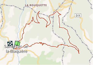
Herault - St-Jean-de-la-Blaquiere le bois de Latude 14km 384m

RandoVal
User

Length
14.2 km

Max alt
452 m

Uphill gradient
427 m
Km-Effort
19.9 km

Min alt
156 m

Downhill gradient
427 m
Boucle
Yes
Creation date :
2021-04-24 19:28:33.885
Updated on :
2021-04-25 14:53:52.679
--
Difficulty : Unknown

FREE GPS app for hiking
 SityTrail
IGN / Geographical institutes
SityTrail Plus
The world is yours!
About
Trail Walking of 14.2 km to be discovered at Occitania, Hérault, Saint-Jean-de-la-Blaquière. This trail is proposed by RandoVal.
Description
Encours
Positioning
Country:
France
Region :
Occitania
Department/Province :
Hérault
Municipality :
Saint-Jean-de-la-Blaquière
Location:
Unknown
Start:(Dec)
Start:(UTM)
534017 ; 4840262 (31T) N.
Comments